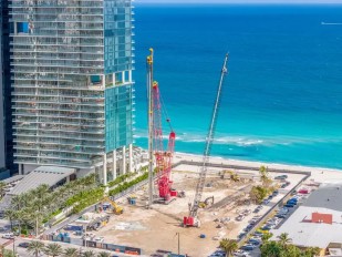
GEER report of the 2026 Mindanao Earthquake is published and available online!

A full report on the investigation of the 2026 Mindanao Earthquake has been published on the GEER website. The report documents the immediate geotechnical and structural impacts of the earthquake and summarizes field observations, ground-motion records, and remote-sensing analyses from the affected region.
Report Summary:
On June 8, 2026, a magnitude 7.8 (M7.8) earthquake struck off the southern coast of Mindanao, Philippines, as a result of thrust faulting originating along the Cotabato Trench subduction zone where the Philippine Sea plate subducts westward beneath the Sunda plate. The mainshock triggered severe ground shaking across the region, reaching a maximum instrumental intensity of VIII on the Philippines earthquake intensity scale. The earthquake caused over 100 fatalities, widespread injuries, and significant disruption to critical infrastructure, including hospitals, schools, power grids, and transportation networks.
Initial field responses in the affected regions were undertaken by the Philippine Institute of Volcanology and Seismology (PHIVOLCS) and the Philippine Society for Soil Mechanics and Geotechnical Engineering (PSSMGE), whom the Geotechnical Extreme Events Reconnaissance (GEER) team later connected with as part of the work undertaken for this report. To rapidly assess the widespread impacts, the GEER team aggregated and synthesized remote sensing data generated by various scientific organizations into an interactive online platform (https://philippines2026.zevizar.com/). The compilation of third-party Synthetic Aperture Radar (SAR) and optical imagery analyses indicates severe clustering of building damage in General Santos City, substantial coastal uplift of up to 2 meters in Sarangani, and significant decreases in nighttime illumination across affected municipalities.
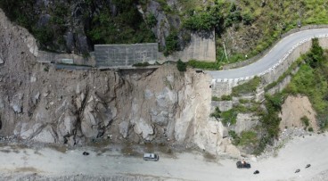
Geotechnical failures were widespread and heavily impacted local communities. Earthquake-induced landslides were prevalent following the M7.8 earthquake, particularly in the provinces of South Cotabato, Sarangani, and Davao Occidental. Remote sensing data mapped by PhilSA suggests many earthquake-induced landslides across several barangays in multiple municipalities including Glan, Sarangani and in Jose Abad Santos, Davao Occidental. Some landslides led to river damming that increased the risk of flash flooding for downstream communities. Severe liquefaction and lateral spreading were confirmed in low-elevation coastal plains and floodplains, manifesting as sand boils, differential settlement, and extensive ground fissures—particularly notable in the Hicban Subdivision of General Santos City.
Ground motions were recorded at strong motion stations deployed and staffed by PHIVOLCS. The closest recording to the earthquake fault rupture was station GSP (General Santos City), approximately 60 km away from the earthquake epicenter. The horizontal components of shaking measured peak ground accelerations (PGA) of approximately 0.29g. The intensity of shaking was also corroborated with recorded instrumental intensity and ShakeMap grids with estimates of several intensity measures across the region.
This report summarizes the immediate post-earthquake geotechnical and structural observations to provide a foundational dataset for future research. While preliminary data highlights the extensive impact of the earthquake, significant gaps remain regarding exact field measurements, quantitative economic losses, and detailed performance assessments of specific sites and infrastructure. The conclusions section of this report suggests several areas of future work.
Want to read more like this story?
Geotechnical Earthquake Engineering
Apr, 21, 2020 | Education

Study suggests that smaller earthquakes generate most strong ground motions
Jan, 04, 2021 | NewsAccording to a new study, smaller earthquakes have caused the strongest shaking incidents in the vi...
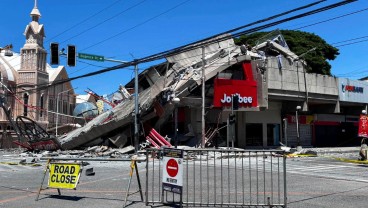
Major earthquake in southern Philippines causes deaths and widespread damage
Jun, 08, 2026 | NewsA powerful magnitude 7.8 earthquake struck off the coast of Mindanao in the southern Philippines, ki...

New GEER report on the 2014 Iquique, Chile Earthquake
Oct, 27, 2014 | NewsA new GEER report was recently released on the geotechnical aspects of the April 1, 2014 M8.2 I...
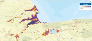
Landslide and liquefaction mapping becomes critical after major quakes
Jun, 29, 2026 | NewsRecent major earthquakes in Venezuela and the southern Philippines have highlighted an important les...

Earthquakes triggered by landslides
Jul, 02, 2020 | NewsIt is widely known that earthquakes can trigger disastrous landslides but, what about the opposite?...

Alaska rocked by M7.0 earthquake as aftershocks intensify, raising infrastructure risks
Dec, 07, 2025 | NewsA magnitude 7.0 earthquake struck near Yakutat, Alaska, triggering more than 160 aftershocks within...

Powerful earthquake struck Mexico: At least one fatality
Sep, 08, 2021 | NewsAt least one person died after a M 7.0 earthquake hit southwestern Mexico on September 8, 2021. Th...

Mexico City Earthquake GEER Report Ver. 1
Oct, 17, 2017 | NewsAn intraslab subduction zone earthquake of moment magnitude 7.1 occurred on September 19, 2017 appro...
On This Day
September 24th 2015
READ MORE
Trending
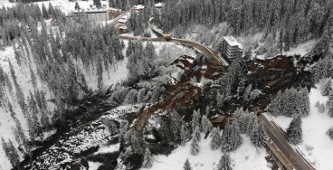
Active landslide threatens long-term connectivity in southern Bulgaria


PLAXIS example: Westergaard's added mass for hydrodynamic pressures

Rock Mass Classification Systems: A Global Review of Use and Dominant Approaches

How does the Leaning Tower of Pisa survive earthquakes
Nepal’s Himalayan settlements face escalating flood and landslide threats